Flux · Flux.1 dev
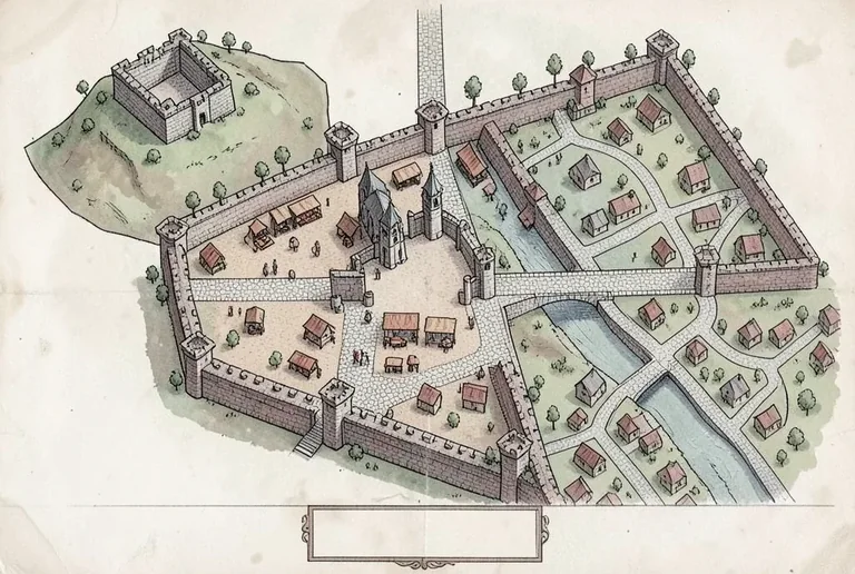
Medieval City Map — Aerial Cartography
Tested: 2026-08-09
3:2 · 768 × 516
The prompt
Prompt
A medieval city map drawn in a top-down bird's-eye cartography view, a walled city with four main gates at the cardinal directions connected by cobblestone roads, a central market square with small drawn market stalls, a cathedral with a bell tower at the city centre, a river flowing through the eastern quarter with a stone bridge crossing it, narrow winding streets in the residential district drawn as thin grey lines between small pitched-roof buildings, a castle on a raised mound in the north-west corner with a separate inner wall, tiny drawn trees lining the main avenues, a small blank rectangular area at the bottom reserved for a title cartouche, no text, no letters, no street names, hand-drawn medieval cartography style with ink linework and muted watercolour wash in stone-grey, terracotta, and sage on aged paperHow to use this prompt
- 1
Open the generator that matches the model and version above, and start a new image rather than editing an existing one.
- 2
Set the output to 3:2. That is the only output setting recorded for this entry, and it is what produced the 768 × 516 image on this page.
- 3
Paste the prompt exactly as written. Changing the wording changes the image, so copy it before you edit.
- 4
Generate, then change one thing at a time. The result will not be pixel-identical to the image on this page, because no seed is recorded for it.
Only an aspect ratio is recorded for this entry; the Flux entries in this library that do carry a step count and CFG value are marked in the parameters panel. Where none are shown, the prompt text and the aspect ratio are all that was recorded.
Related prompts
More prompts from the same model, and prompts that share a use case with this one.